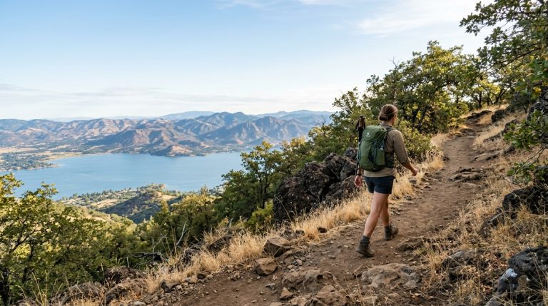
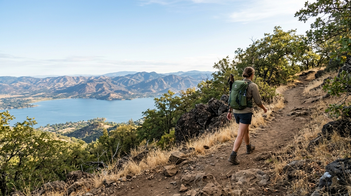
Mount Konocti rises above the south shore of Clear Lake and gives Lake County a defining landscape. From towns around the water, the mountain appears close and familiar. From its trails, however, the scale changes: oak woodland opens toward broad lake views, old orchards reveal the area’s agricultural past, and volcanic rock makes the climb feel unlike a typical foothill hike.
The Wright Peak Summit Trail is the best-known route in Mount Konocti County Park. It is a moderately strenuous outing with roughly 1,600 feet of elevation gain over about three miles from the upper parking area, making the return journey close to six miles. The climb rewards prepared hikers with wide views across Clear Lake and the surrounding ridges, but it should not be treated as an easy sightseeing walk.
This guide explains what to expect, how to prepare, and why the mountain’s geology matters. Always confirm current access, weather, fire restrictions, and trail conditions before departure. For a broader weekend plan, combine the hike with our 48-hour Lake County itinerary or browse more ideas in our Parks and Trails guides.
Plan Your Wright Peak Summit Hike
Mount Konocti County Park lies near Kelseyville on the mountain’s western side. Lake County lists parking, picnic areas, restrooms, benches, trails, and vista areas among the park’s facilities. The park also contains a historic settler cabin and aircraft remains along the route. Conditions and access procedures can change, so use the official Mount Konocti Park page as your first planning source.
Download a trail map before leaving reliable mobile service. The recently updated Konocti Trails website provides current trail-planning resources, maps, difficulty information, and etiquette guidance for Mount Konocti and other Lake County routes. Do not rely only on a screenshot from a hiking app, because closures, muddy conditions, heat, smoke, or maintenance work can affect the experience.
Understand the route, effort, and timing
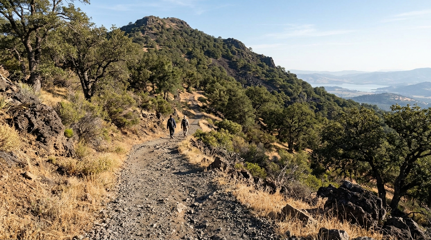
The Wright Peak route follows a broad access road for much of the climb rather than a narrow wilderness footpath. That makes navigation comparatively straightforward, but the sustained grade still demands effort. Hikers move past orchard areas, through wooded sections, and toward increasingly open views. The surface can include loose gravel, uneven rock, dust, and seasonal mud.
Allow several hours for the full outing, including breaks and time at viewpoints. Pace depends on fitness, temperature, trail condition, and how far you choose to go. Reaching the summit is not required for a worthwhile day. Turn around when heat, fatigue, smoke, wind, or limited daylight becomes a concern.
What the climb feels like
The first part of the hike can feel deceptively gentle, especially in cool morning air. As the route continues, the accumulated elevation becomes more noticeable. Shade is inconsistent, and exposed portions can feel much warmer than conditions near Clear Lake. Descending also requires attention because tired legs, loose gravel, and a sustained downhill grade can increase the chance of slipping.
Use a steady pace from the beginning. Take short breaks, drink regularly, and eat small snacks during the climb. Hiking poles may help with balance and reduce strain on the descent, but they do not replace footwear with reliable traction.
Choose the right season and start time
Cool, clear mornings generally provide the most comfortable hiking conditions. Spring may bring greener hillsides and wildflowers, while autumn can offer crisp views after summer heat eases. Summer requires much more caution because exposed slopes, intense sun, dry vegetation, and high temperatures can turn a manageable climb into a dangerous one.
Start early enough to complete the route without rushing and without depending on the last available daylight. Check the hourly forecast for Kelseyville and the mountain, not only a general Lake County forecast. Wind, cloud cover, and temperature may differ between the shoreline and upper elevations. Postpone the hike during extreme heat, thunderstorms, heavy smoke, red-flag fire weather, or other official advisories.
Pack for heat, exposure, and changing conditions
Carry more water than you expect to need because reliable drinking water may not be available along the route. Bring sun protection, food, a basic first-aid kit, a charged phone, an offline map, and a light layer. Wear closed-toe hiking shoes or trail shoes with good grip. A hat, sunglasses, and sunscreen are essential on exposed sections.
Tell someone where you are going and when you expect to return. Solo hikers should be conservative about weather and turnaround times. Groups should keep everyone together. Children need close supervision, enough water, and a route length suited to their experience.
- Carry adequate water for every person and dog.
- Pack snacks with salt and carbohydrates.
- Download the current trail map for offline use.
- Bring sun protection and an extra layer.
- Keep dogs leashed and remove all pet waste.
- Leave gates exactly as you find them.
- Pack out every item you bring onto the trail.
Respect fire, wildlife, and trail rules
Dry grass and woodland can create serious fire risk. Never smoke, light a fire, use fireworks, or park a hot vehicle over dry vegetation. Follow current county restrictions and leave immediately when officials close the park or issue emergency instructions. Do not assume that a cool morning removes wildfire danger later in the day.
Watch for wildlife without approaching, feeding, or surrounding animals for photographs. Stay on the established route to reduce erosion and protect vegetation. Konocti Trails advises users to avoid trails when deep boot, hoof, or tire prints show that the surface is too wet. When encountering mud, pass through the center rather than widening the trail around it.
Dogs should remain on a short leash around other trail users and wildlife. Bring enough water for them, protect their paws from hot ground, and reconsider the hike when temperatures rise. If you plan to spend time by the water after the climb, read our Clear Lake water-quality guide before allowing a pet to approach the shoreline.
Read the Volcanic Landscape as You Climb
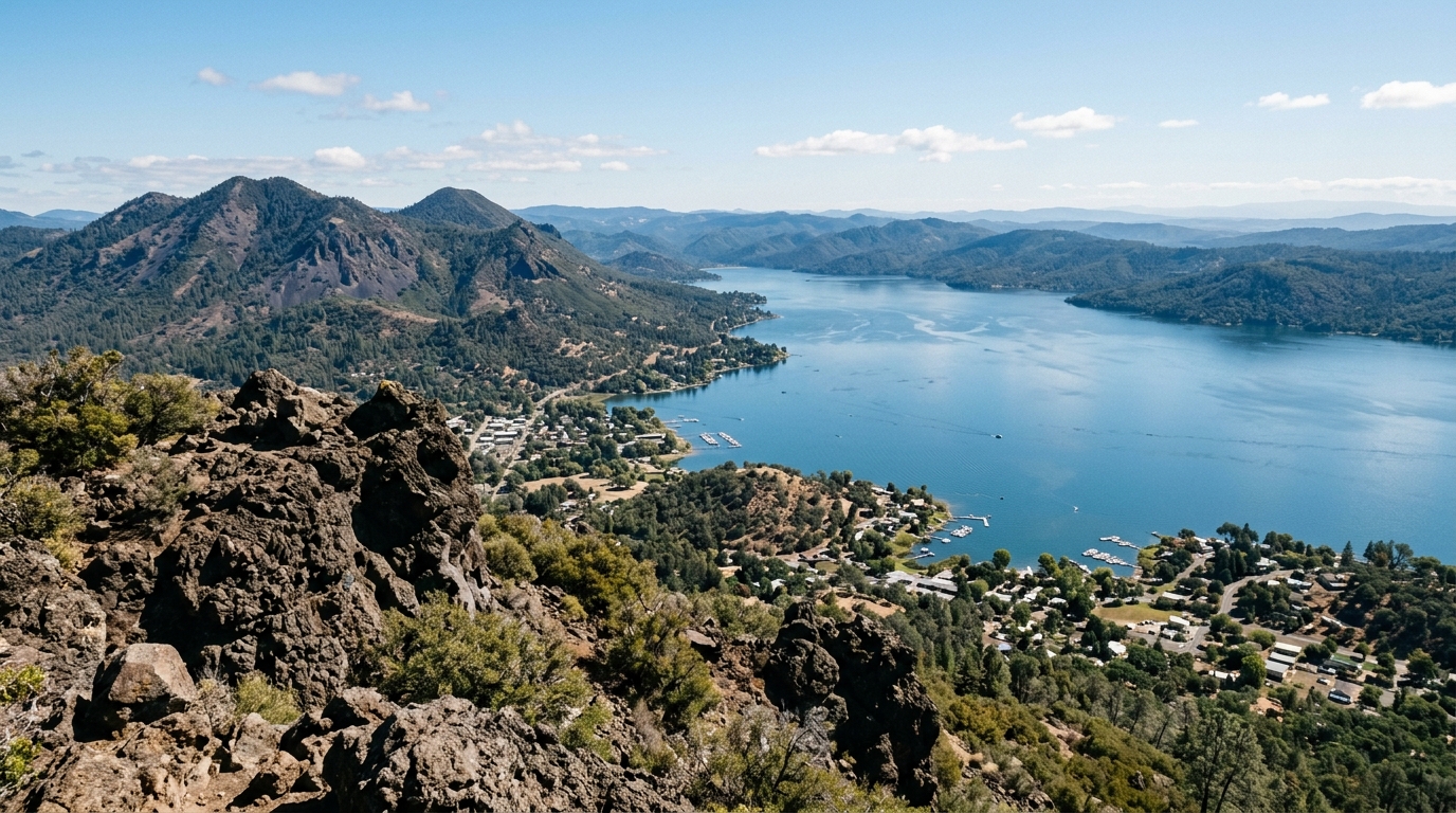
Mount Konocti is more than a viewpoint. It is a mostly dacitic lava-dome complex within the Clear Lake Volcanic Field. The U.S. Geological Survey places the mountain at about 4,305 feet and explains that its major structure began forming roughly 350,000 years ago, with some core samples dated even earlier. The broader volcanic field has produced lava domes, cones, geothermal features, and explosive craters over a much longer period.
These facts help explain the mountain’s shape. Instead of one simple cone, Mount Konocti consists of multiple peaks and volcanic domes. Its rocky slopes, talus areas, prominent ridges, and relationship to Clear Lake reflect a complicated geologic history. Read the USGS volcanic history of Mount Konocti before the trip to understand what you are seeing from the trail.
Connect geology, human history, and responsible travel
The trail also passes reminders that people have worked, traveled, and lived on the mountain. Orchard areas and the historic cabin tell part of the settler-era story, while the mountain and Clear Lake hold much older and deeper significance for the region’s Indigenous communities. Visitors should avoid turning cultural history into folklore or repeating unverified legends as fact.
Use museum, tribal, county, and carefully sourced historical material when learning about the area. Our History and Culture section will provide responsible background without presenting sacred or community-specific knowledge as tourist entertainment.
Why the volcanic story improves the hike
Understanding the landscape changes the experience. A rocky outcrop becomes evidence of lava-dome construction rather than just a photo stop. The mountain’s multiple summits make sense as connected volcanic features. Views toward Clear Lake reveal a region shaped by faulting, volcanism, erosion, water, and ongoing geothermal activity.
The broader Clear Lake Volcanic Field is monitored by the USGS, and its most recent eruptions occurred thousands of years ago rather than during recorded local history. That scientific context should replace exaggerated claims about an imminent eruption. Hiking Mount Konocti is an opportunity to see an important California volcanic landscape while relying on measured, authoritative information.
At viewpoints, resist the temptation to climb unstable rocks or cross barriers for a better photograph. Give other hikers space, keep noise low, and leave natural and historic objects in place. If the summit area is crowded, wait or enjoy a quieter viewpoint below. Responsible behavior protects the trail and preserves the sense of place that makes the mountain distinctive.
After the hike, recover in Kelseyville or spend a quiet afternoon near Clear Lake rather than packing the day with additional strenuous activities. Hydrate, eat, and allow tired legs time to rest before driving winding roads. Continue planning through our Lake County field notes for town guides, water-safety information, responsible boating advice, and seasonal itineraries.
Mount Konocti rewards preparation more than speed. Start early, carry enough water, respect closures, and turn around when conditions demand it. The summit views are memorable, but the stronger experience comes from understanding the mountain as a living landscape of volcanic rock, oak woodland, agricultural history, wildlife habitat, and continuing community significance.